Cedar River Council extends flood experience survey through June
Published 9:50 am Tuesday, May 5, 2026


In March, the Cedar River Council publicly asked, “Were you affected by the December 2025 Cedar River flood?”
And in April, the council shared that over a dozen people responded, with the majority saying, “Yes.”
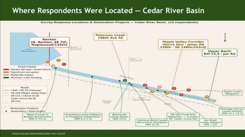
At the April 28 Cedar River Council meeting, the results of the survey were presented and discussed. Over 9,000 GovDelivery recipients were directly notified on the survey, which asked for experiences with the December flooding and how it compared to major flooding along the Cedar River in the past, and 14 people responded.
A summary of the responses showed eight out of 14 surveyed said that the recent flooding was the most severe they had experienced at their location.
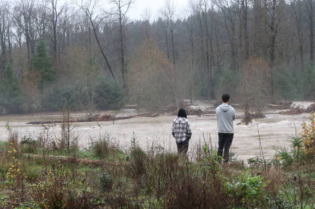
Four of the responses said that they had also experienced the November 1990 flood of record, where the Cedar River crest height hit 17.13 feet, setting a record. The recent atmospheric river flooding had beaten that record on Dec. 11, 2025, with a height of 18.25 feet.
One quote used in the summary, by a Maple Valley respondent in the Dorre Don area said: “Our elderly neighbors here for 60 years also said it’s the worst they’ve ever seen.”
Other individual accounts that were highlighted in the summary described their experiences as the following:
• Maple Valley Corridor (Dorre Don, Jones Road, 228th)
“Reported approximately $150,000 in damage and described their home as uninhabitable.”
“Described floodwaters they estimated at 4-plus feet deep, moving vehicles and sheds.”
“Some respondents described flooding they believed reached pre-Phase 1.”
• Renton (North Renton, Southeast 7th, Maplewood/135th)
“Bridges and Cedar River Trail closed; major mobility disruption.”
“First ever interior flooding at their home, estimating 28 inch depth.”
“Neighbors sandbagging to prevent neighborhood flooding.”
• Upper Basin/ Landsburg (RM 13.5, Jan Road)
“Described floodwaters reaching their foundation for the first time.”
“One respondent believe Jan Road channel work shifted low patterns and washed away plantings.”
“Road access cut off for multiple days.”
• Peterson Creek (196th Avenue Southeast)
“Calm tributary flooding — pastures inundated as in past years.”
“No property damage; waters described as calm enough to canoe.”
“Riverbend restoration site appeared to reduce flooding.”
The summary included responses to the flood levels, saying that “several respondents expressed a desire for updated risk information near their properties,” and that one respondent “described learning after the event that flood insurance differs significantly from homeowners insurance.” Some respondents had also expressed “a desire for more information about flood insurance and preparedness before a flood event.”
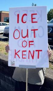
As far as dam safety, the presentation showed that one respondent had brought up a dam further upriver. According to the summary, the Maple Valley resident has said the following unprompted: “Having lived in MV lifetime, we are well aware of cracks in the flood control dam.”
Giving background and information and context, the presentation explained that the Cedar River watershed includes Masonry Dam and the Landsburg Diversion Dam, which are both operated by the City of Seattle and out of the scope of the Cedar River Council’s jurisdiction. It was noted that any questions about dam conditions or operations are to be directed to the City of Seattle.
Due to the low number of respondents to the survey, the council approved the reopening of the survey, which would be included in targeted in mail-ins to basin residents for the “I ♥ Cedar River” event on June 25. The survey has officially been reopened and allows for more submissions through June 2026.
The new survey response to the Cedar River December Flooding, along with the summary from the April 28 meeting, are available at kingcounty.gov.