Maple Valley Highway near I-405 partially closed due to mudslide
Published 9:40 am Wednesday, December 17, 2025
As the December atmospheric river continues to rip through the Pacific Northwest, Renton has been dealing with floods, heavy rain, high winds and oversaturated soil.
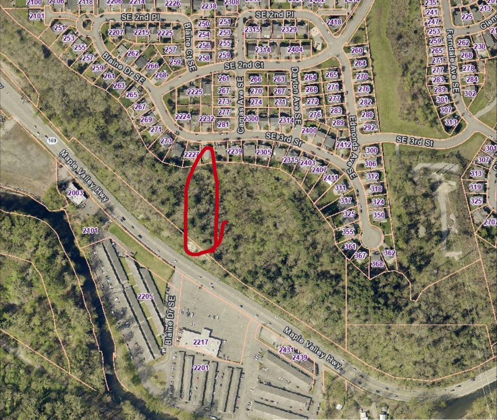
Late evening on Tuesday, Dec. 16, a mudslide took place on State Route 169 across from the Riviera Apartments and Blaine Drive Southeast and before the Renton Community Center and exit to I-405. The westbound lane was temporarily closed and the highway was reduced to one lane before reopening early Dec. 17.
Further east on SR-169, aka Maple Valley Highway, the eastbound lane was closed near Maplewood Roadside Park and Southeast 5th Street due to soil erosion caused by flooding.
Cedar River water levels
As of 2:15 p.m. Dec. 17, the Cedar River flooding level is at 14.54 feet. According to the United States Geological Survey (USGS), the flood levels are at moderate levels and the King County Flood Warning Division has raised the Cedar River from a phase three level back to a phase four.
Forecasts from the National Oceanic and Atmospheric Administration (NOAA) currently predict that flood levels will recede below 13 feet by 10 p.m. Wednesday, Dec. 17.
For those who need sandbags, materials can be procured at King County, which is open 24/7, at 3021 Northeast 4th Street, and Renton Public Works Maintenance Shop at 3555 Northeast 2nd Street, which is open 7 a.m. to 4 p.m. Check in at the A-1 Building for the latter.
The City of Renton asks that residents check with the Emergency Management division website for updates.